Note: I listened to the velvet-smooth singing of Kent, Washington rising star Tess Henley for this entire caper. If you are going to read this all, I encourage you to listen to these two songs while you read:
And if you aren’t going to listen to music, check out these two songs (and more) anyway: They are fabulous.
Onward…
This has, for us, been busy. Very busy. Good busy, but something had to fall off the table in order for me to prepare for car shows and in-laws, and anniversaries, and kids coming home from college and then going back, and on and on.
So I relinquished first mountaineering, and then, in the last month or so, almost all of my hiking. I’m out of shape, and…letting go of things we hold precious, even for a bit, is healthy: It’s easy to fall into the trap of thinking that the things about which we are passionate identify us. Taking a break is dissociative. It also helps me rediscover my appreciation for those things.
The in-laws and other family have departed, as well as daughter-the-oldest, back to college. The bathroom remodel is done (mostly), and the car show schedule is winding down for the year.
And for the first time in months I got up on Saturday without a long list…or any list at all of things that had to be done. I slept in and took it easy. Which left me with some energy for today.
A thing about fitness: Being light and strong and fast in the mountains is a magical thing. However, when I’m off-peak, I can really feel it. And I’m off peak. It’s frustrating and I’ve been running what I wrote above through my head over and over for the last few weeks: It was a choice to take a break. And I can reclaim the lost ground. Today was about starting that, AND, more importantly, getting an unpeopled, un-dogged, peaceful, adventurous day of wandering about in the mountains.
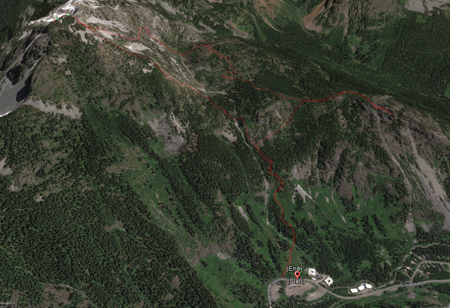
I’ve made the traverse from Snoqualmie Mountain to Guye Peak quite a few times. And every time I’ve ended up thrashing upward through brush from the saddle between Snoqualmie and the casual trail across Cave Ridge; the connection from the saddle to that trail has always eluded me. I figured the easy (at least from a route-finding standpoint) way to suss this out would be to reverse the route- start with Guye and then traverse over Cave Ridge to Snoqualmie.
After a late-night movie, I wake up at the crack of 9:00 AM and finally roll out of the house around 11:30. At 12:30 I walk out of the parking lot, up the closed road, and cut off onto the unmarked trail. I smile as this whole outing will be on my kind of trail: Steep, direct, un-screwed with by the WTA et al, and, for much of time, seldom-used.
In a typical year I’d be firing up the trail in my light boots. Today I’m wearing heavy boots for added exercise, and I’m on what I call an “all day” pace. Breathing hard and sweating in the 100% humidity air, but not pushing as hard as I can.
At the turnoff for the Guye Peak trail I smile, as the sign has, after decades, finally fallen off the tree. This is not a trail for beginners and it’s not a trail for people who can’t do some route finding; signs and cairns get people in trouble as much as they help.
I cut right across and up the boulder-strewn slope. Near the saddle the rocks give way to soft, gentle duff that is easy on aging knees and ankles and lovely.
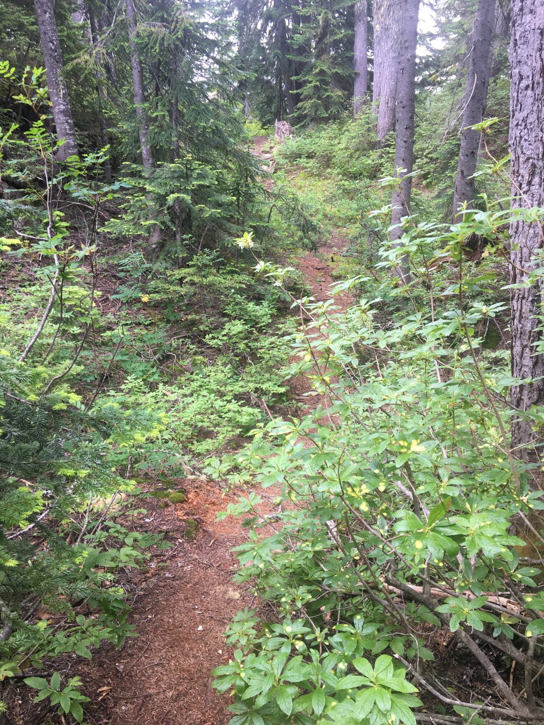
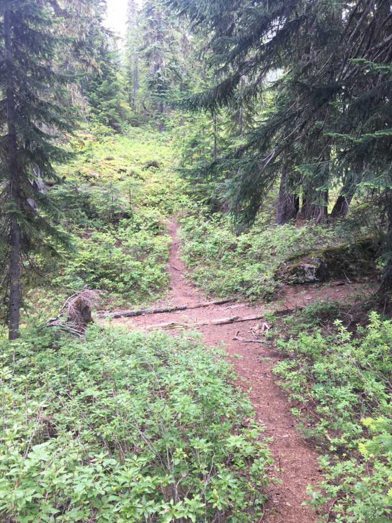
A perfect trail in the woods.
At the Guye Peak tarn I once again screw up and miss my preferred trail (this is okay and my fault, not indicative of a need for more signs or a ‘fixed’ trail). Mistakes are okay. We learn from them.
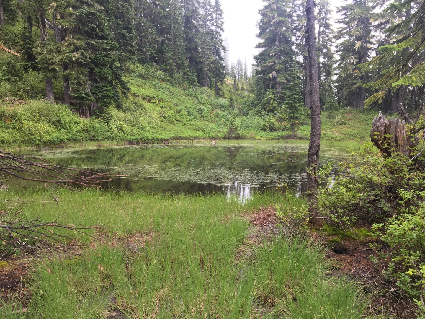
The picturesque tarn below Guye Peak. Two casual trails lead to the summit from here. Two trails are okay; there is no need to ‘decommission’ one. Take one up and the other down; they are different in character.
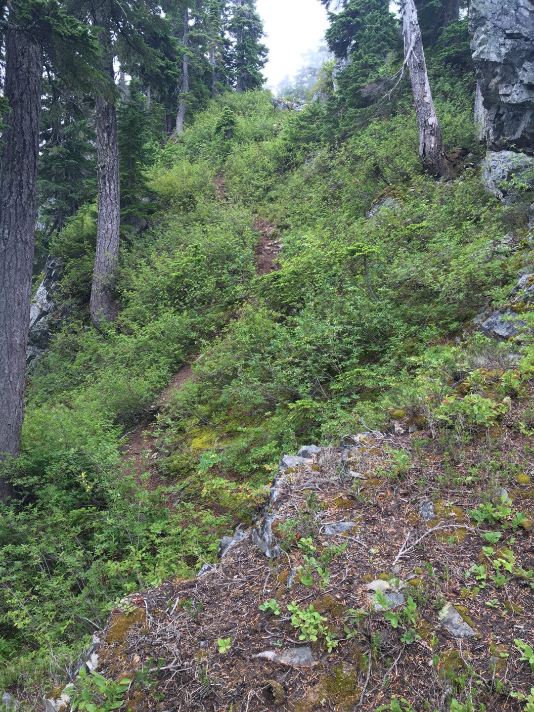
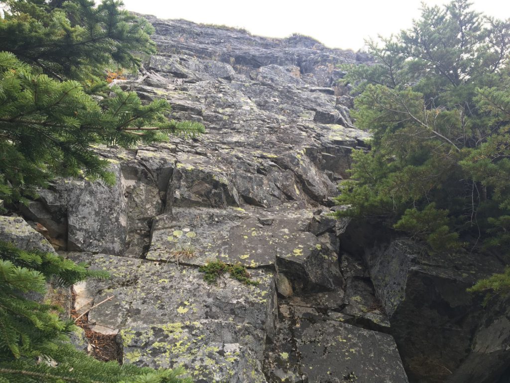
The left (east) side trail above the tarn. Again, perfect.
The trail eases back as the trees thin out and then I’m on the tiny, exposed north summit of Guye Peak.
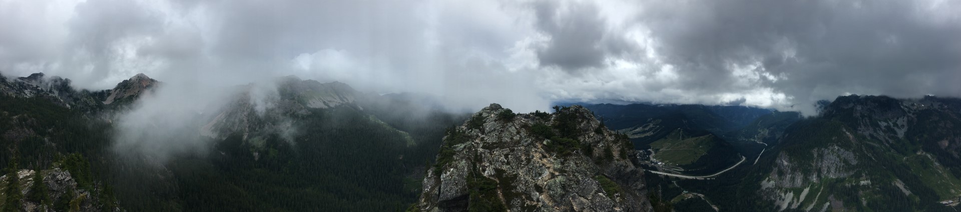
Pano from the north peak of Guye Peak.
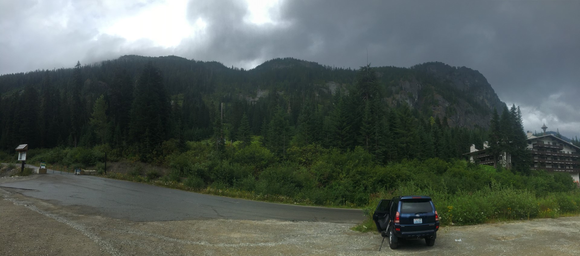
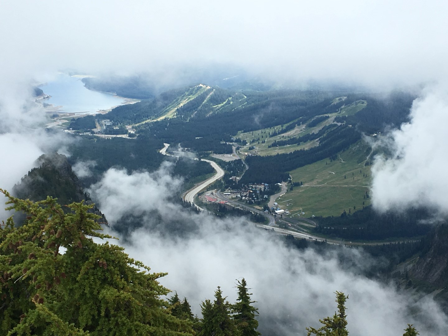
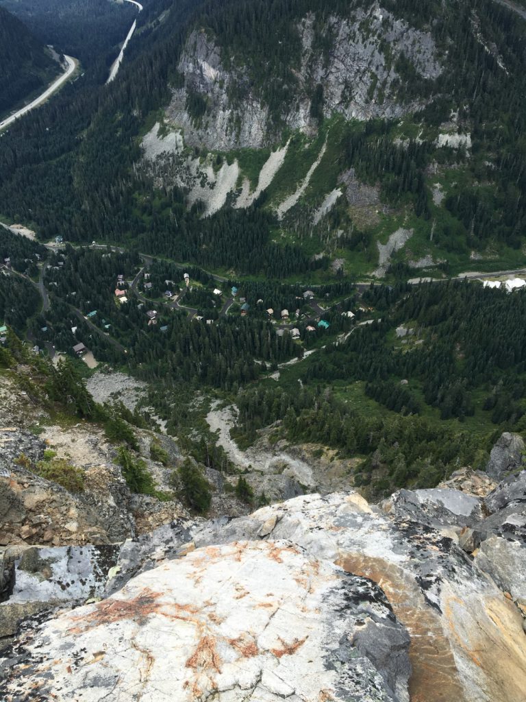 Ski chalets far below in the valley.

Guye Peak has three summits, all within just a few feet of being the same altitude. Getting from the north summit to the middle summit is not trivial. I hadn’t been on the middle or south summit since 2001, when I climbed the south rib solo and traversed over the mountain, descending the standard route. After some contemplation, I decide to have a look at the crux move again after so many years. It’s below the north summit on the west side, just above the dead-vertical 600 foot west face. The rock is solid, but the required moves are actually slightly overhanging and a fall, well, don’t fall. I carefully pick my way down, then scramble over to the middle and north summits.
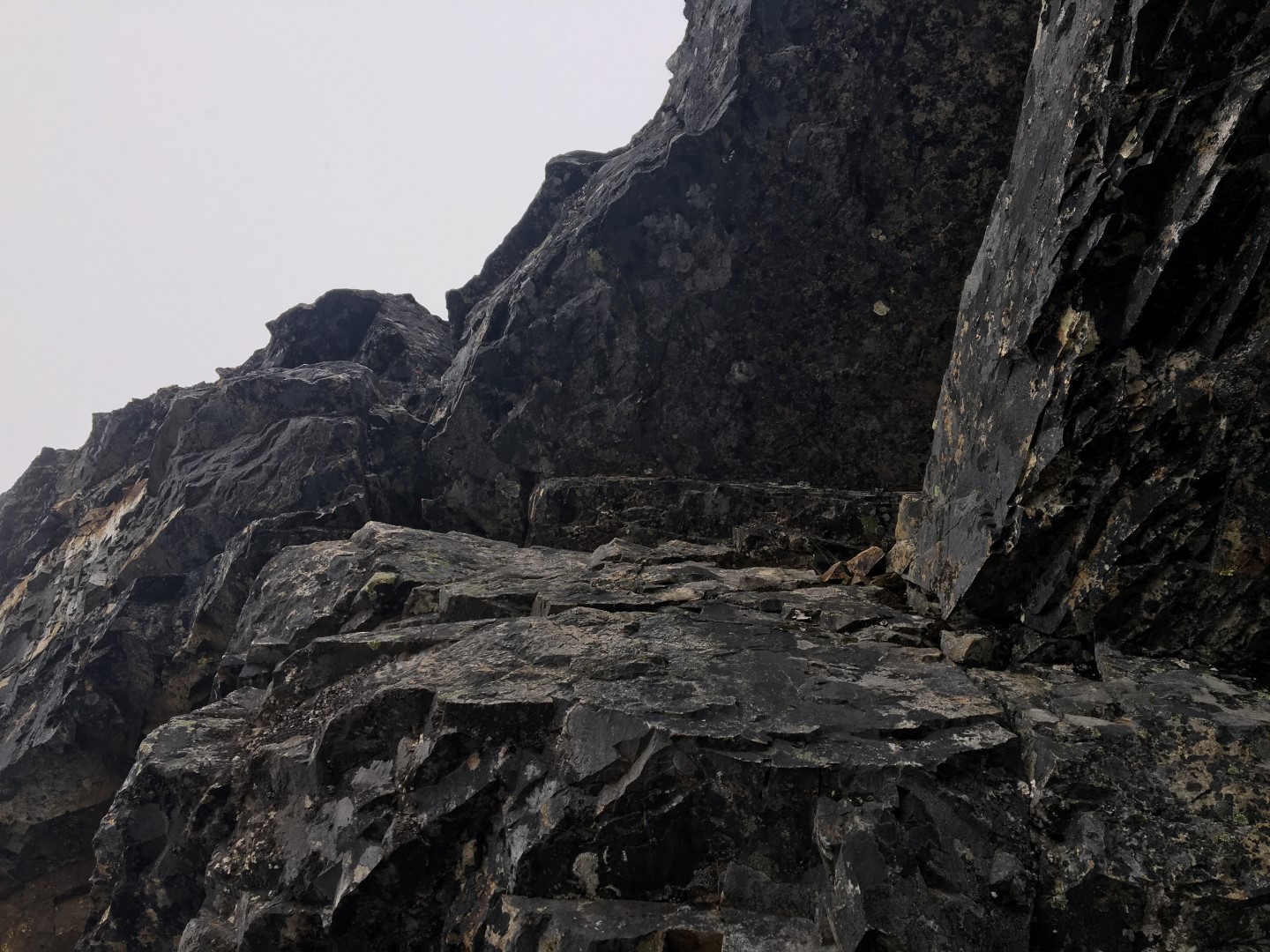
The crux section between the middle and north summits.
 The crux section between the south and middle summits. Steep, but excellent hand and feet, and solid rock.

The view from the south summit: Snoqualmie Pass and Lake Kachess through a window in the clouds.
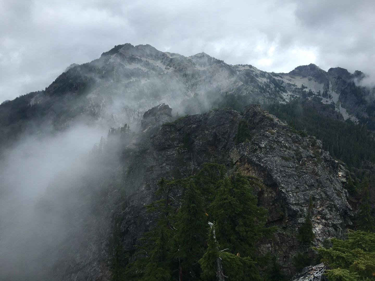
Looking back over the middle and north summits with Snoqualmie Mountain towering behind.
After a brief pause to reflect on my last visit to the south summit, it was my first trip into the mountains after my Dad died in 2001, I head back over- reversing what I’d done to get there.
I’ve always wondered what this rap station (and the one below it) are about. There’s no need to make a rappel on the east side, where these are, to get between the summits.
 The tiny, exposed north summit. Descend to notch, then go down and left to the exposed, solid 4th class moves. And don’t fall.
I’d forgotten that those 4th class moves are harder on the way up than the way down. This isn’t usually the case, but this spot is an exception. I suck it up and carefully climb up, thankful for solid rock and good holds.
I head immediately down, toward the tarn and trail up and over Cave Ridge. I’d come up the western trail, but go down to the tarn on the eastern trail.
 Rain hitting the tarn below. It rained or drizzled intermittently all day. Just fine with me as it kept the crowds and bugs down.
 To misquote Yogi Berra, when you reach a crossroads, take it. I came up from the left and turned right to go up Guye. To the right goes down to the Commonwealth Basin. Straight on to Cave Ridge!

The trail over Cave Ridge is just exquisite, wandering on soft duff in and around small alpine firs. Oh, and caves. It’s called Cave Ridge for a reason!
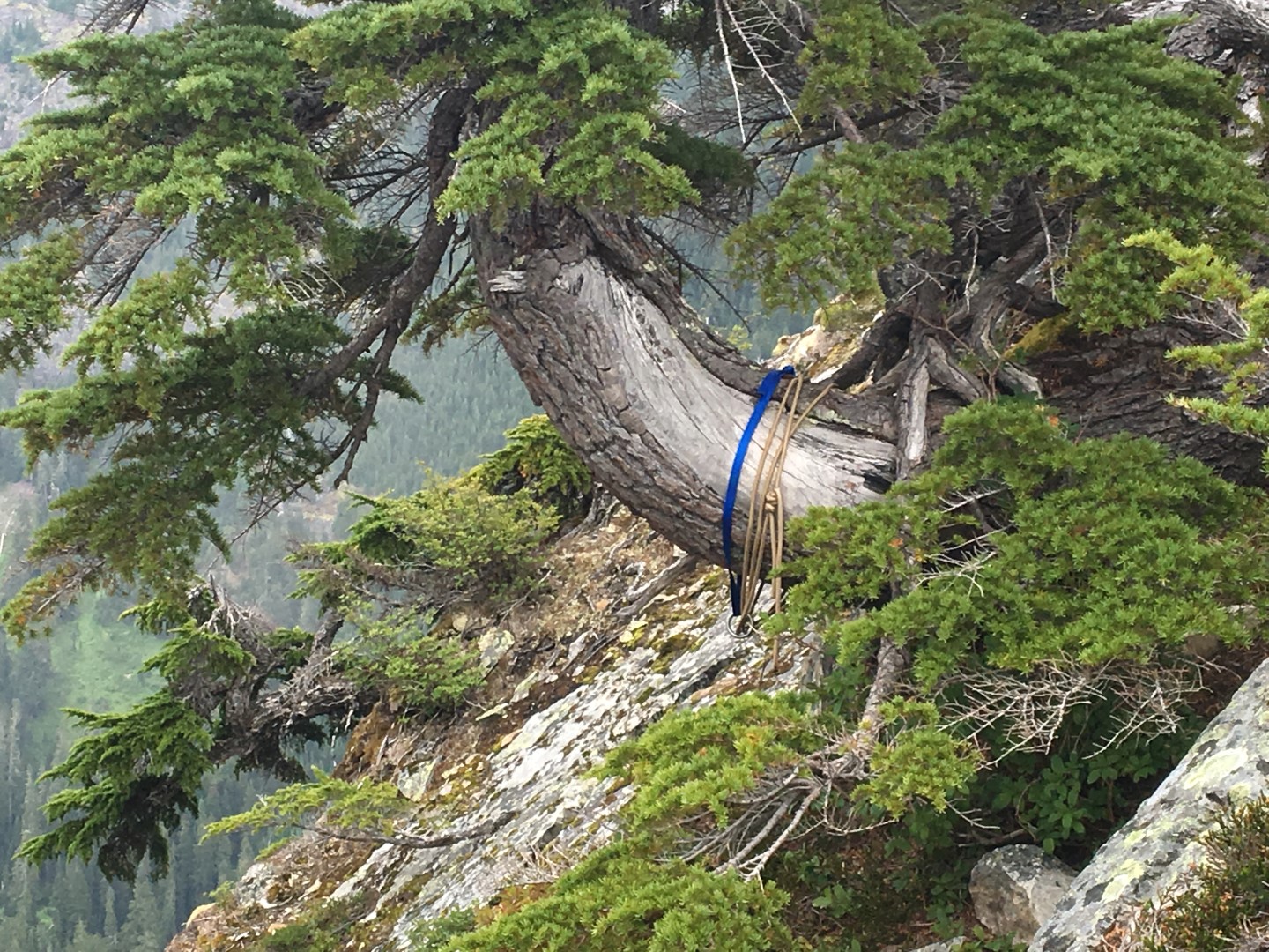
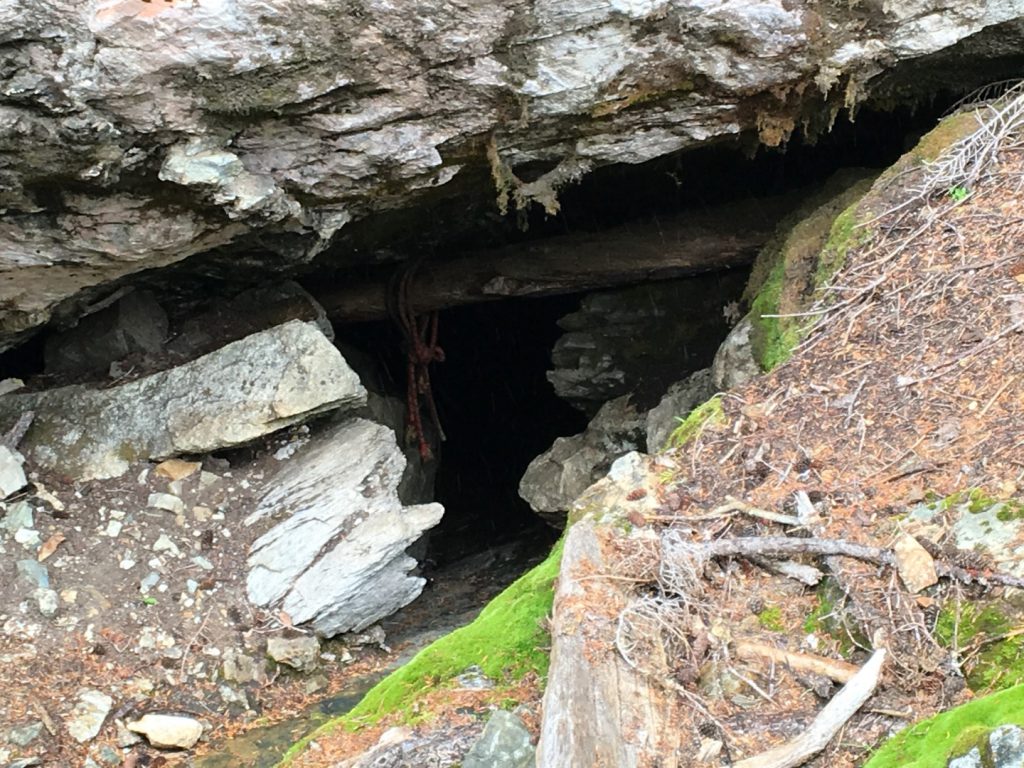 This cave has a shaft entrance, requiring an immediate rappel. In the Midwest it would have all sorts of warning signs, or even a gate. Here, where caving isn’t such a thing, just the anchor ropes tell the tale.

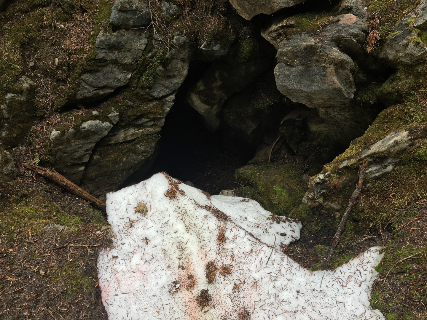
 The cold air exiting this cave, as well as its location and aspect, keep the snow cool and around deep into the summer.
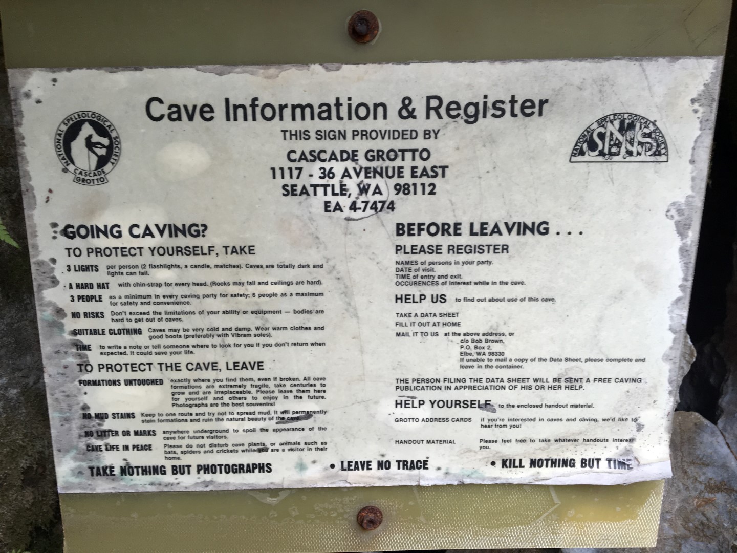
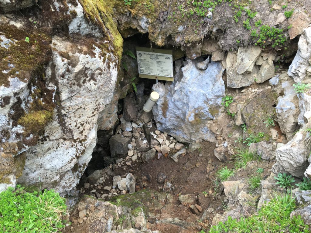 This cave has a sign and a sign-in tube, but closer inspection reveals that it’s ancient.

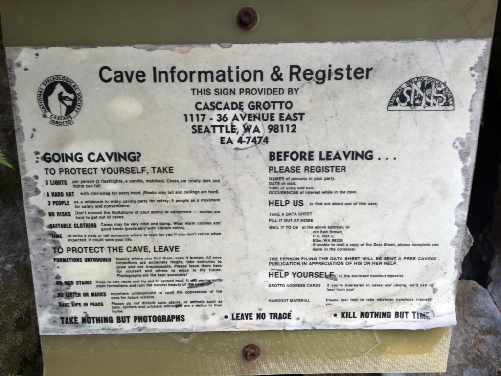 I’m not sure when the two-letter prefix phone numbers were abandoned, but I’d guess it was the 50s or 60s, so this sign is OLD. The tube supposedly full of registration forms was empty.
As I approach the saddle between Cave Ridge and Snoqualmie Mountain I’m several hundred feet up the ridge and above the saddle, and the trail is ascending. I pause and consider dropping down cross country to where I can see the trail below. Then I think better of it and continue up the faint trail, which I’ve never walked. Something new, an adventure. And an unknown- I have no idea how or if I can keep going up here and make it up Snoqualmie without dropping all the way back down.
So upward. Following my nose.
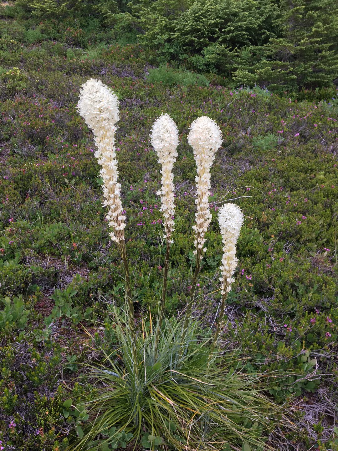
Beargrass is an early bloomer. This spot on Cave Ridge must melt out late.
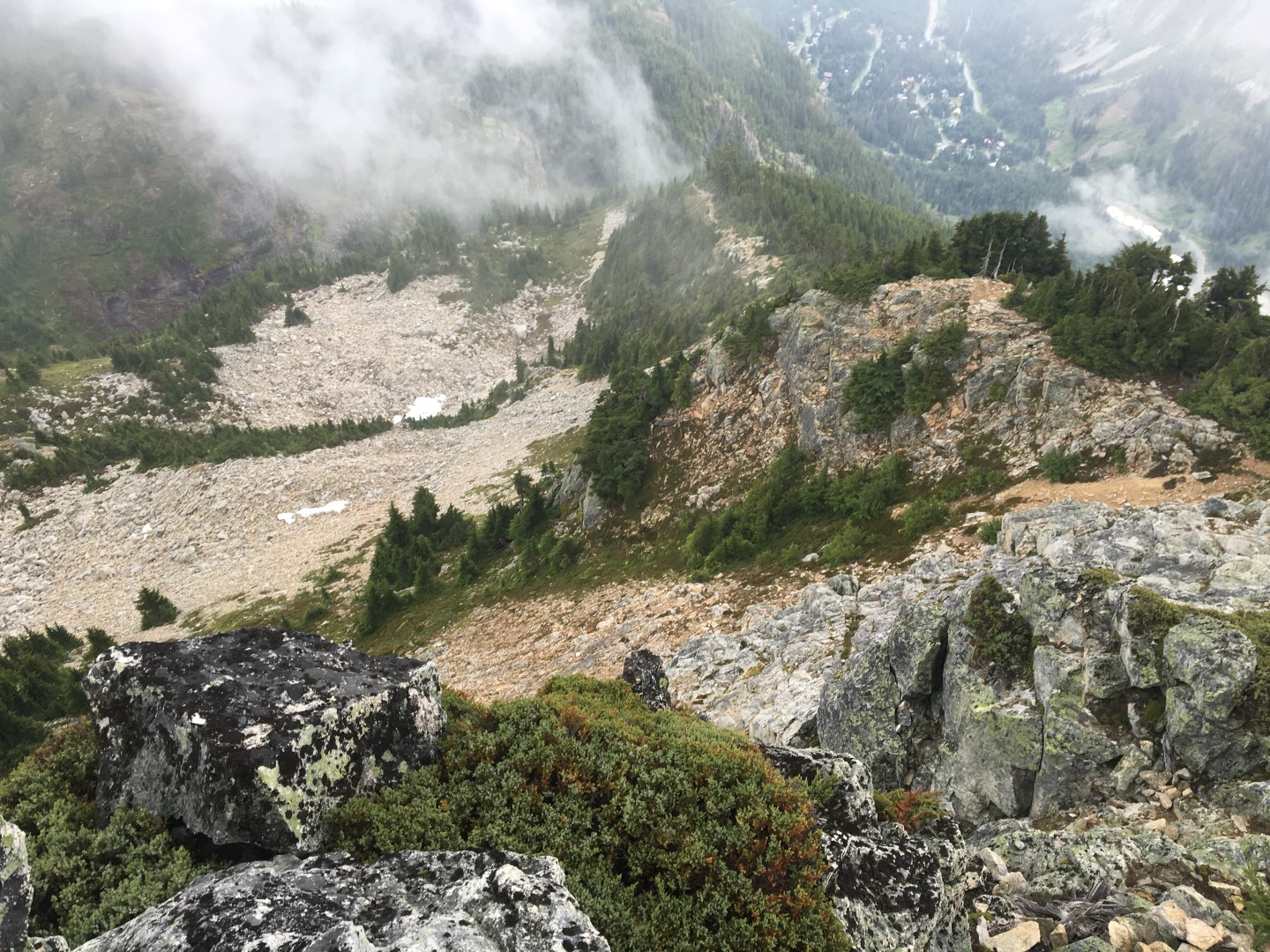
Eventually I reach a spot where it’s only 150 vertical feet or so, on a very faint (probably game) trail to get into the valley below. The clouds are blowing in and out and I can’t tell from here how or even if there is a high route onto Snoqualmie, but I can sort that out later.
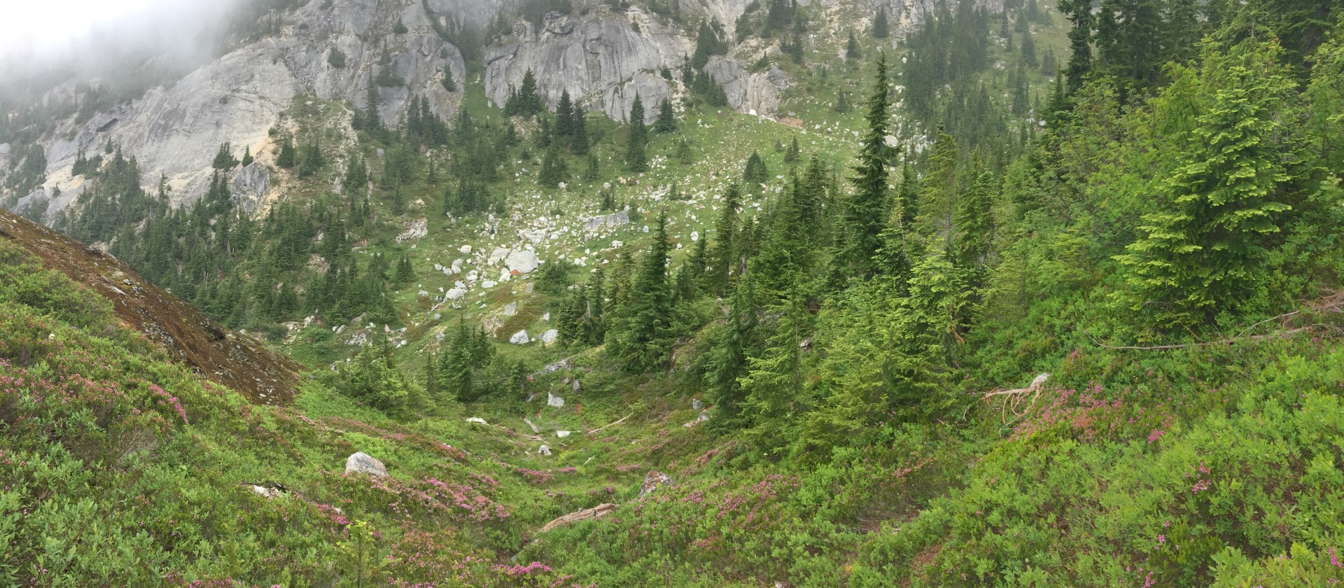
A pano looking down the slope toward the valley. It wasn’t nearly as far as it looks. I wrenched my knee going down it- very unusual for me to slip and tweak something other than my ankle.
The trail-ish way I’m following fades out just above the valley bottom and now I’m really finding my own way. I cross the valley bottom, opt against turning right to gain an easy ridge crest, and instead head directly upward to the north. On a clear day navigation would be somewhat easier, but I’m familiar with the area and I know where the top of Snoqualmie is from where I am; onward up I go.
I reach a drainage that clearly used to be persistent snow and find a small remnant bit of snow/ice in it. Here I have to chose to stay on the left of the drainage or cross over to the right. I look up both ways. Right looks more difficult but also more likely to reach interesting terrain above. Right I go.
This turns out to be something of a mistake, as it’s steeper than it looks. The area with dirt gets narrow and too steep to ascend safely. The rock to the right has some beautiful moss on it. It’s been raining off an on all day, so that beautiful moss is slick as snot and the rock isn’t much less slick. I suck it up and carefully move to the 30 or so feet of tricky rock to easier ground.
Now I can see that I’ve reached an upper basin east of and well below the main trail up Snoqualmie. Below and to my left I can see the trail. But I don’t want to go down. My goal is to find a way to walk as little of the trail as possible on the way up.
Two draws ascend to the upper part of the summit ridge. The right, higher draw looks a bit steep, with my assessment colored by my recent experience on the mossy rock. I aim for the left draw, which is lower, but well above me still.
As I ascend I discover a very welcome surprise. Food.
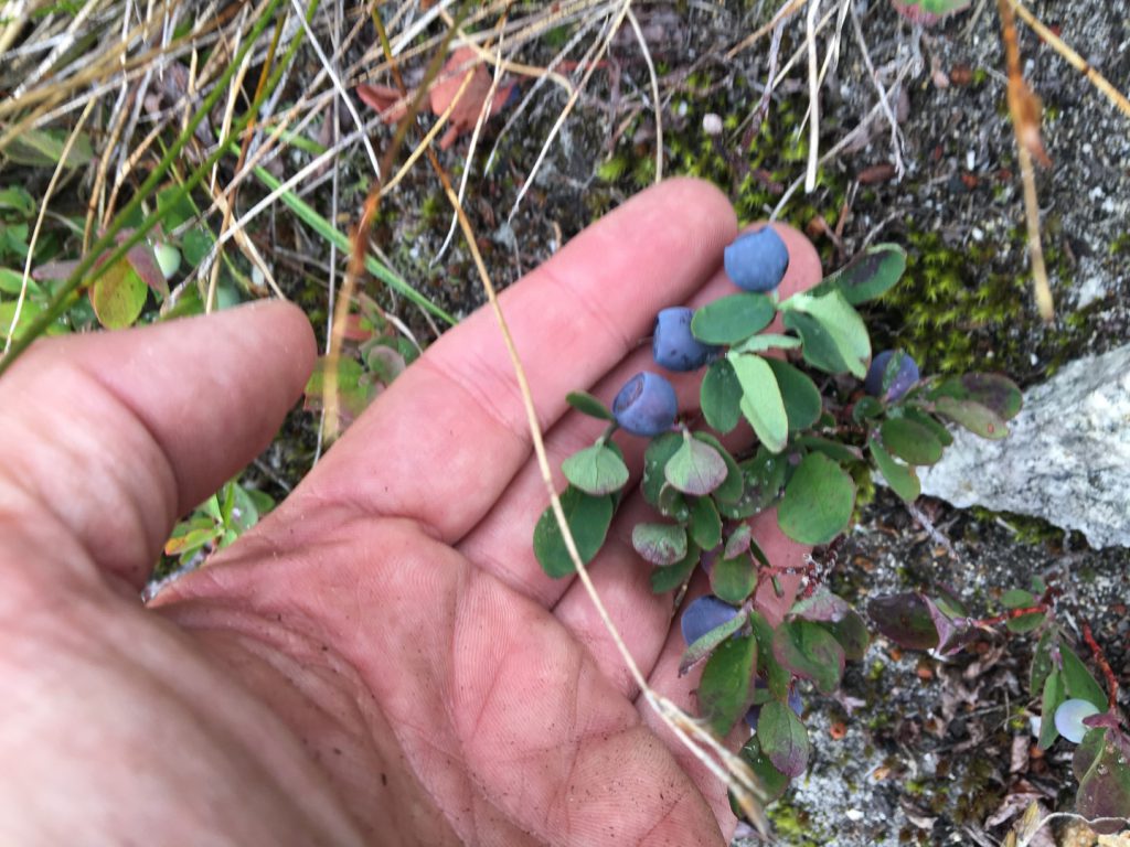 Wild huckleberries are always cause for celebration in the mountains.

My upward progress is significantly slowed as I gobble up the berries and slowly meander up. They are nourishing, refreshing, and thirst quenching. With a new outlook, I again peruse my two ascent options and find that the preferred right option looks entirely manageable. I change course and aim for it, still stopping occasionally to sample the bountiful berries.
Near the head of the draw, close to the ridge, something of a way trail appears. I often see this near passes that animals use- near the pass their travel is constrained, but they diffuse their use as soon as possible. In this case, however, I find myself smiling as the trail to the summit appears right in front of me. I learned to pick out cross-country routes above the trees from Thomy; it’s a skill/sense that I highly value and enjoy honing. Ten minutes later I’m atop Snoqualmie Mountain. Of note: So far I have seen a three people in one group, about 30 minutes up the trail, way at the beginning of the day. This is my kind of day.
Here you can see the trail running up the ridge (far below). I reached the ridge via the reddish rocks and green treed (and huckleberried) slope to the left, just ten minutes below the summit.
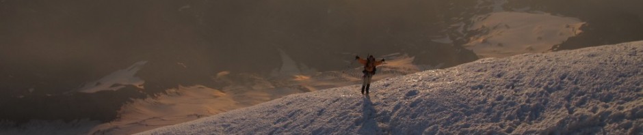
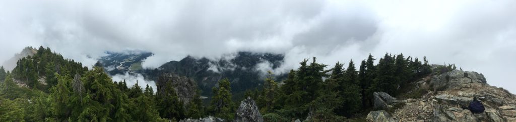 Snoqualmie Mountain summit panorama. “How do you deal with the rain?” is a question I often hear. The short answer is that there is profound beauty here, even on rainy days.

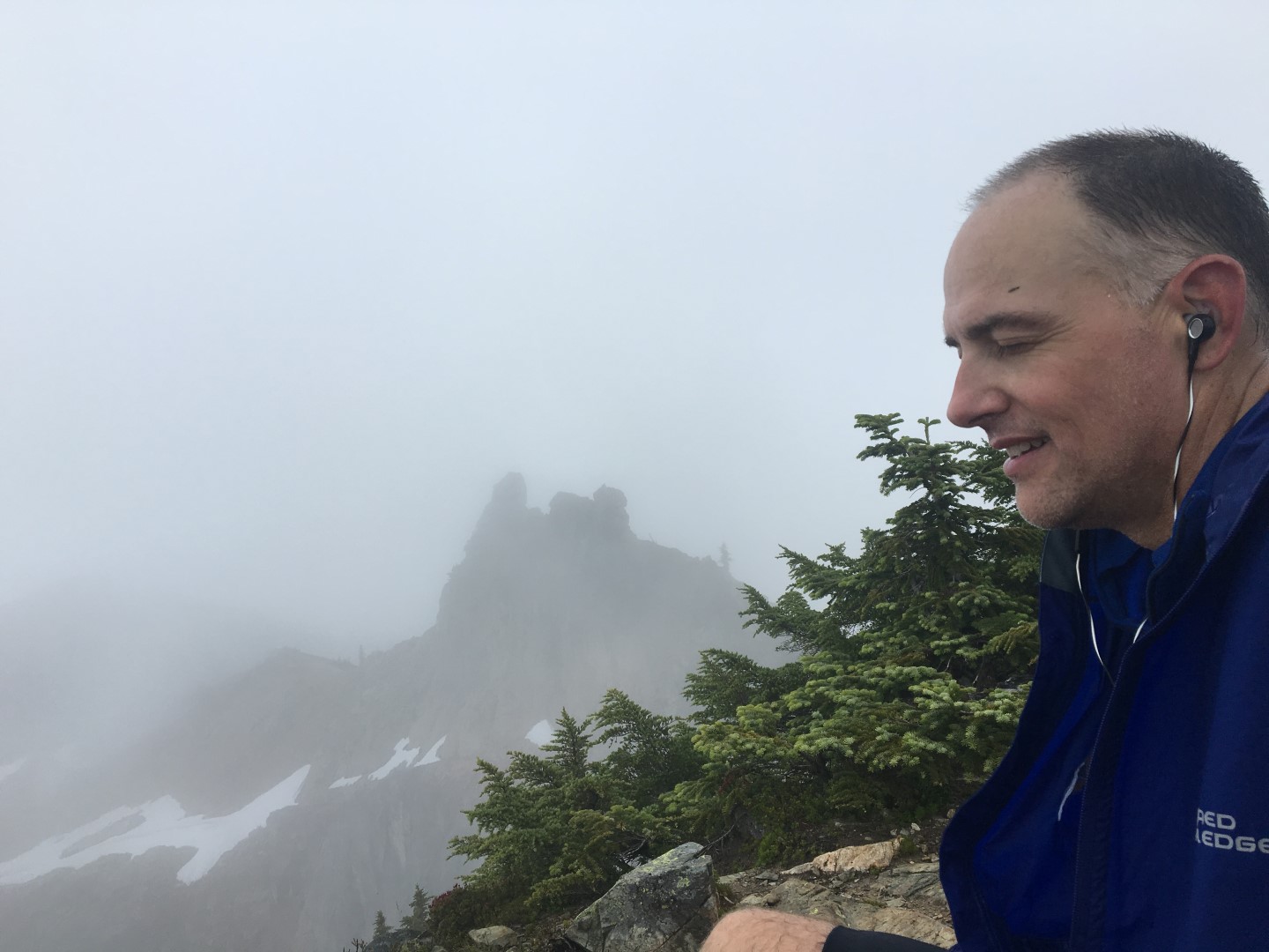
Contemplating my day on a foggy summit. Yes, I am listing to the music I recommended earlier.
Here I finally look at my phone and post a pic to the Facebooks. Then I load up and head down, forgetting to eat or drink…at this point I’ve eaten one Clif Bar, the huckleberries, and a half quart of water since starting. I have calories that need burned off.
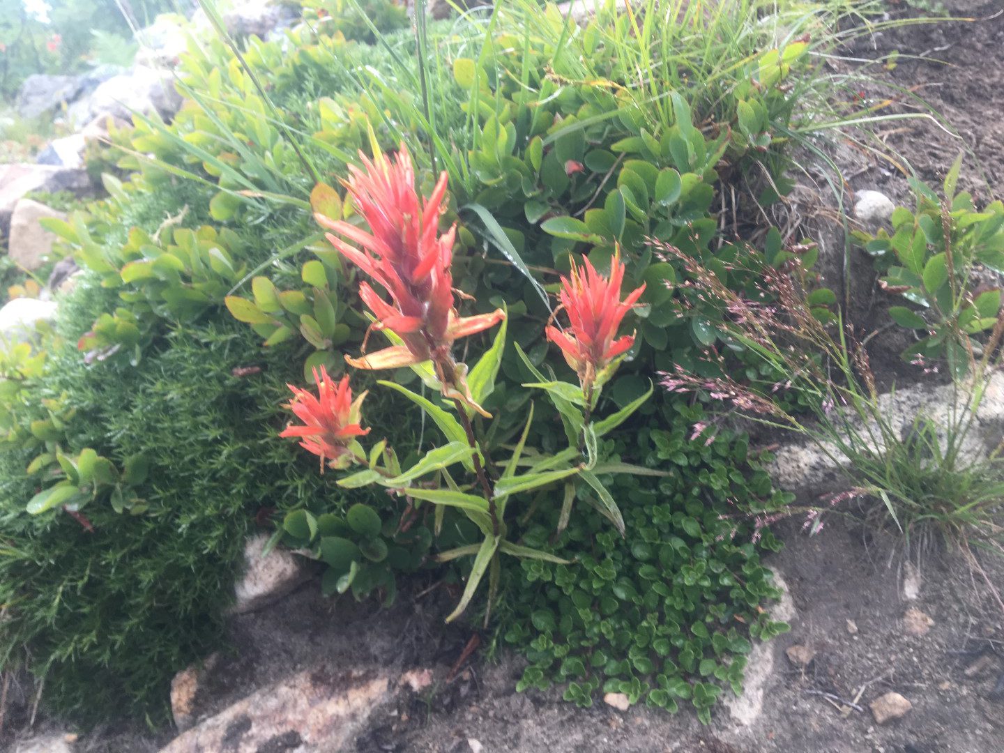
The route down is very familiar. I stop to snap a few pics, including some Indian Paintbrush for my buddy Thomy. He introduced me to wandering and cross-country exploring in the Cascades, and Paintbrush is his favorite. I also nick my shin on a rock, causing some consternation for the three groups I pass on the way down. My right leg took the brunt of the woundage today.
 Indian Paintbrush.
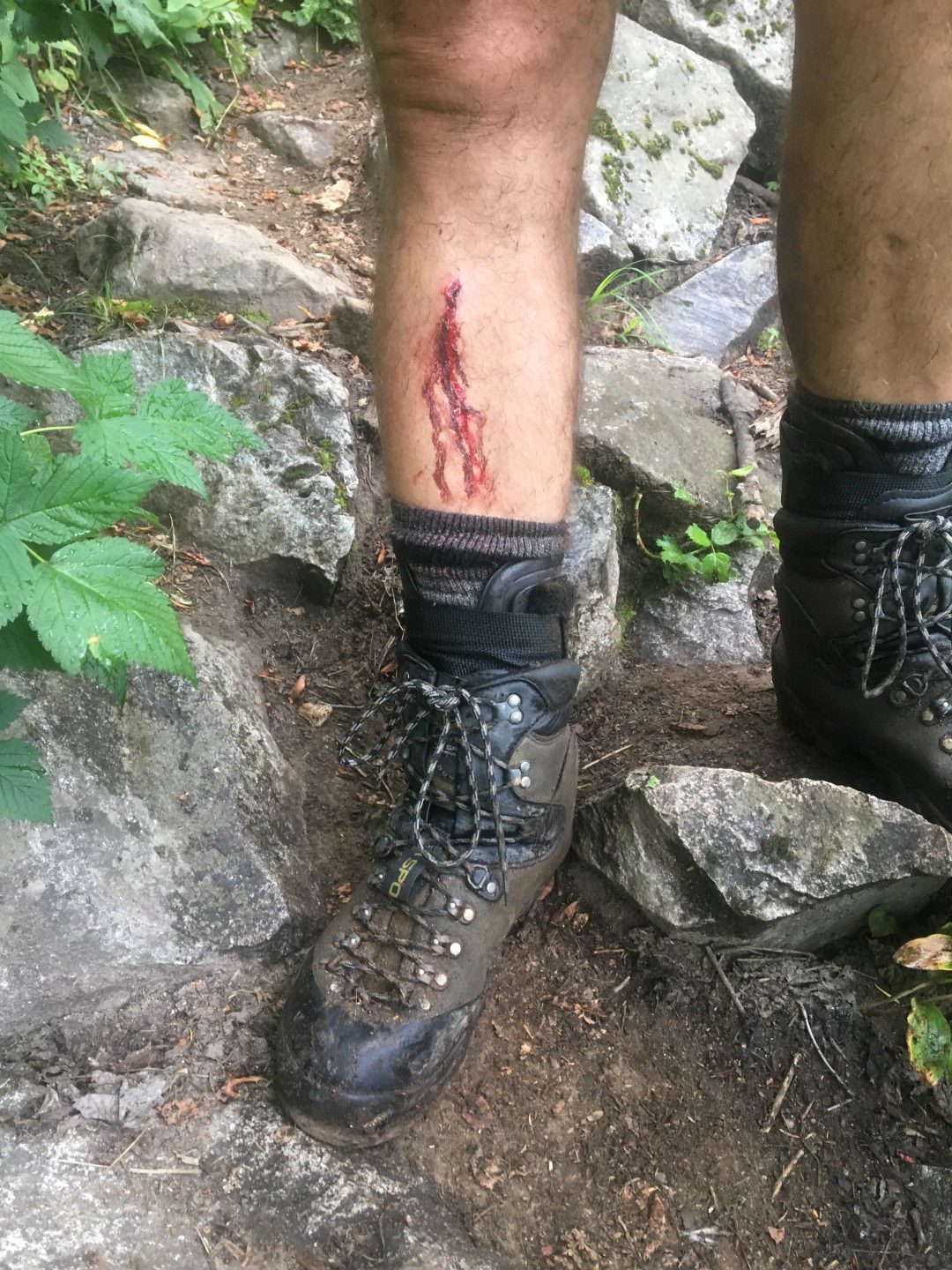
Tis but a flesh wound, you have not cut off my leg!
Four hours and forty-eight glorious minutes after leaving the car, I am back. New territory explored, a mystery solved (the Cave Ridge trail does NOT drop down the low part of the saddle), and a heaping dose of much-needed solitude and mountain rejuvenation obtained. Ahhhhhhhh.